


GR01 SJO Great Route of São Jorge 01 (Stage 1 Closed) - São Jorge
Trail Info
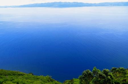
The GR01 SJO Great Route of São Jorge 01 covers approximately half of the Island, in a linear route that connects the parish of Topo, in the Eastern part of the Island, with the Fajã dos Cubres, on the North coast. It has an extension of approximately 40 km.
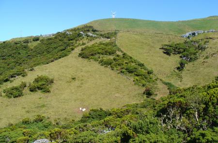
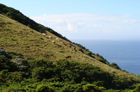
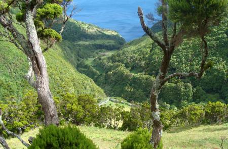
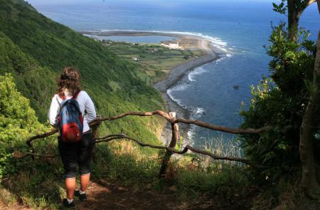
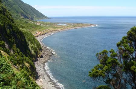
This trail alternates from the plateau of the inner part of the island, where the volcanic cones that generated the Island were born, with the high, steep cliffs that come to an end in small flat areas at the sea level, the famous landscapes of the Fajãs of São Jorge.
Whenever possible, enjoy the natural bathing areas to relax and revitalize. The urban and rural centres should be used to purchase any supplies you might need for the hike.
The trail is divided into two stages, of approximately 25 km and 15 km. You should plan your walk according to your physical ability, interests and availability. There are stations and designed places to spend the night (Local Lodging and Rural Tourism facilities), as wild camping is forbidden.
Outline
Trail Information
GR SJO 01 Stage 1 - Topo/Fajã dos Vimes CLOSED
Extention:25 km
Duration: 05h30
After heavy rainy days, avoid the trail Lourais/Fajã dos Vimes due to the difficult crossing of the streams.
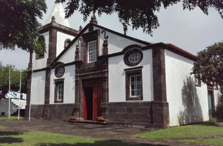
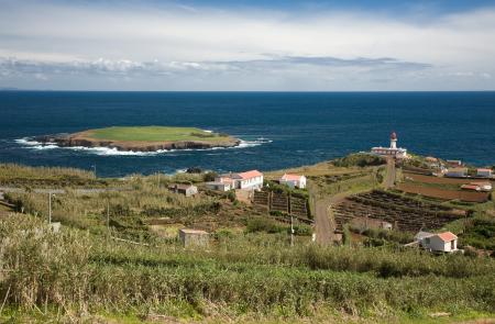
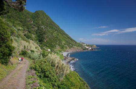
Begin this leg near the lighthouse of Ponta do Topo, with view over the islet of Topo and the island of Terceira. Follow the marks near the coast until the center of the village, passing by the convent Convento Franciscano of São Diogo. In here, it is possible to make a small detour until the recreational harbor, passing by the house Casa dos Tiagos, building from the 19th c. and classified as of public interest. On the way back, you will cross an old Whale Watching tower, being nowadays a viewpoint.
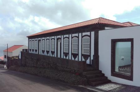
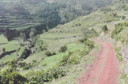
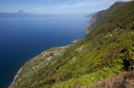
The path through the South coast will pass by Santo Antão, São Tomé and goes down the road of Saramagueira until Fajã of São João, a place of narrow streets and traditional Portuguese flooring. Pass by the church towards Lourais, crossing small agricultural fields that along the climb, give place to woods.
Before Lourais, cross the stream of Salto and the locality and proceed, on a descending sense, through a dirt road towards Fajã dos Bodes. Continue the trail with a view of the islands of Pico and Faial, Fajã dos Bodes, Vimes and the village of Calheta. Arriving to Fajã dos Bodes, follow the marks near the coast until reaching Fajã dos Vimes.
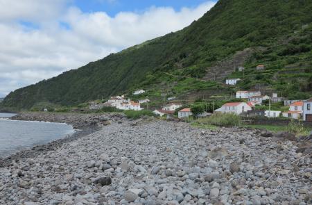
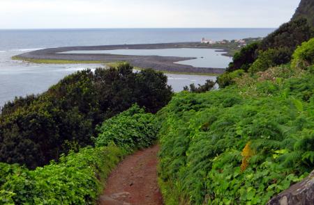
Go down the road until the recreational harbor, place where this leg ends and where you can profit to have a swim. Here, there is a connection with several other points of the island through the walking trail PR 09 SJO – Fajã dos Vimes/Fragueira/Portal, or to the next leg of the Grand Route, connecting Fajã dos Vimes to Fajã dos Cubres.
Inside fajã, profit to visit the handicraft workshop where the traditional quilts are made and taste a coffee produced locally.
GR SJO 01 Stage 2 - Fajã dos Vimes/Fajã dos Cubres
Extention: 15 km
Duration: 06h00
This leg of 15 km connects Fajã dos Vimes (South coast) to Fajã dos Cubres (North coast). Along the trail and whenever necessary crossing a gate, always leave it closed.
Begin the leg on an ascending dirt road heading Serra do Topo, passing by the intersection to Fragueira (PR 09 SJO – Fajã dos Vimes/Fragueira/Portal). Choose to go on your right hand side until you arrive to a tarmac road, stay right and cross a spring known as Fonte de Água Azeda. A few meters ahead, choose a road on your left hand side, going up a cliff by a stone stairway, usually shaded by a wood of Australian Cheesewood (Pittosporum undulatum). At the end of the stairway, the ground may be muddy or/and slippery being advisable the use of proper footwear.
Arriving to a gate, turn left and enter a dirt road flanked by Hydrangeas (Hydrangeas macrophylla), ending at the regional road, near the Eolic Park of Serra do Topo. Proceed until you find the direction to Fajã de Santo Cristo and follow by an descending dirt road towards Caldeira de Cima. Cross the bridge Tia Júlia, proceeding very carefully (slippery ground) through a detour on your right hand side heading Cascate Pequena.
Continue until the fajã, passing by a viewpoint, the church Santuário do Senhor Santo Cristo and by the Centre of Environmental Interpretation. At this place, you can visit the Lagoa da Caldeira do Santo Cristo, classified as protected landscape area of Fajãs do Norte, geosite and place of natural, cultural and landscaping interest.
Continue near the coast, passing by Fajã do Belo, inhabited until the earthquake of 1980. From here, it is already possible to see Fajã dos Cubres ahead, place where this leg ends, near the church of Igreja de Nossa Senhora de Lourdes. Here, there is a connection to several other points of the island through the leg of GR 02 SJO, connecting Fajã dos Cubres to Santo Amaro.


