


Grande Rota do Oeste - Terceira GR01TER
Trail Info
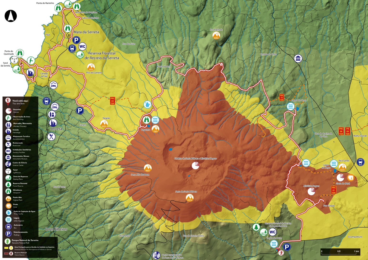
The GR01 TER West Great Route covers the west part of the island, in a linear route that connects the Forest Reserve and Recreation Park of Lagoa das Patas to the Forest Reserve and Recreation Park of Mata da Serreta. It has an extension of approximately 31,2 km.
This trail prompts hikers to get acquainted with its rich and vast natural, scenic, social, and cultural heritage. Throughout this route it is possible to observe a wide range of landscapes, natural communities and ecosystems, such as recreational areas, coastal cliffs, semi-natural forests and mountain areas.
The trail is divided into two stages, of approximately 21,9 km and 9,3 km. You should plan the walk according to your physical ability, interests and availability. On the western part of the island, there are accommodations (local lodging and rural tourism facilites) to spend the night, as wild camping is forbidden.
Contorno
Informazioni
STAGE 1 LAGOA DAS PATAS - PICO NEGRÃO CHIUSA
Extension: 21,9km | Time average: 07h00
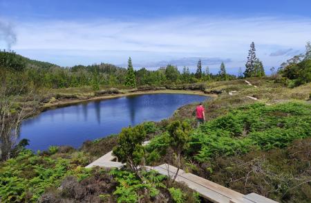
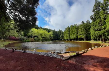
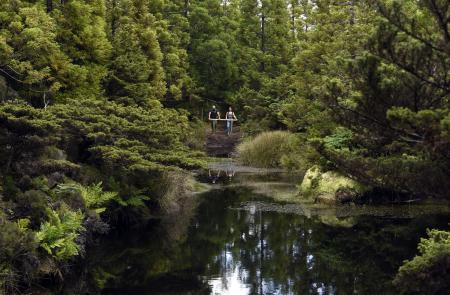
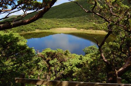
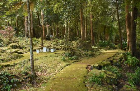
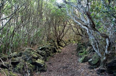
Start this stage at the Forest Reserve and Recreation Park of Lagoa das Patas. Follow the road towards the volcanic cone of Pico Gaspar and, from there, to Mistérios Negros (PRC 01 TER) until Lagoinha do Vale Fundo. Take the old pathway and follow the forest trail north of the mountain. Head down to Lagoa do Cerro where a shelter for birdwatchers can be found. Return to the detour point and head west. Following through forest paths and among hedges of cryptomeria (Cryptomeria japonica), find the ascent to Lagoinha da Serreta (PRC 03 TER) surrounded by endemic species, which is embedded in the flank of the Serra de Santa Bárbara. Take the same path downwards, follow straight ahead and head down through the pasture on the right, skirting the valley of Ribeira do Além. Follow the trail marks to the car park, where this stage ends. The next stage of this Great Route connects this location to the coastline, from Pico Negrão to Mata da Serreta. It is recommended to hike this stage with good weather and visibility, since it mostly takes place in an area with an altitude above 500m.
STAGE 2 PICO NEGRÃO - MATA DA SERRETA
Extension: 9,3km | Time average: 03h00
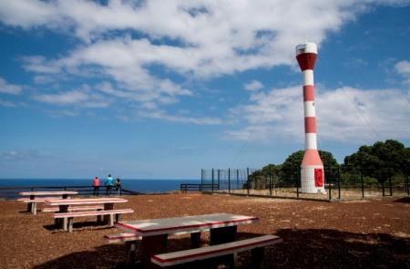
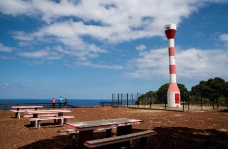
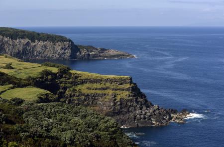
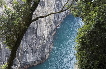
This stage connects Pico Negrão to the Forest Reserve and Recreation Park of Mata da Serreta along an extension of 9,3 km. It is the westernmost section of this Great Route and it bears the lowest altitude. Start the descent on the tarmac road leading to forest paths with rocky terrain, among semi-natural forests of New Zealand Christmas Trees (Metrosideros excelsa). Head through the small patch areas built with basaltic stone enclosures (curraletas) used in the past to grow vineyards, until an area with an automated light, as well as a viewpoint and a picnic area are reached. In this location there was once a lighthouse, which was destroyed by the earthquake in 1980. Proceed through the pathway along stunning, steep cliffs where Cory’s Shearwater birds (Calonectris borealis) nest. Upon reaching a small chapel linked to the appearance of the parish church of Serreta, follow the trail to the Fajã, which was formerly used to connect the western parishes of the island, along orchards, beehives and livestock farms. Then, head past a picnic area with a whale lookout point of previous great importance for whaling. Afterwards, the Raminho viewpoint provides views from the cliff of the northern coastline. On the final section of this stage, go through the forest once again until the picnic area of the Forest Reserve and Recreation Park of Mata da Serreta is reached. This stage ends in this well-equipped picnic area including a cryptic fountain. Make sure to visit the centre of the parish with its colorful shrine, the church, and the typical local cuisine restaurant.


