


Costa Norte - Santa Maria PR01SMA


Trail Info
This small linear route connects the village of Bananeiras to Anjos, in a small walk along the North Coast of the island.
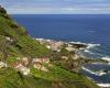
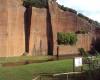
Leave Bananeiras towards Baía do Raposo. This trail, often used by people that go fishing to the bay, classified as Geosite, allows you to visit two watermills, the stream that feeds them and a mill belonging to the local vineyards, presently in ruins.
Leaving the bay, go up the hill where you can see some species of natural flora such as White Wood (Picconia azorica), Fayatree (Morella Faya), or the Cabaceira (Pericallis malvifollia) and introduced species such as the Australian Cheesewood (Pittosporum undulatum), Giant Reed (Arundo donax) and the Maguey (Agave Americana). Along the trail you can observe and hear some birds like the Buzzard (Buteo buteo rothscildi), Blackbird (Turdus merula), Common Chaffinch (Fringilla coelebs moreletti), Santa Maria Goldcrest (Regulus regulus sanctae mariae), Atlantic Canary (Serinus canaria) or European Robin (erithacus rubecula).
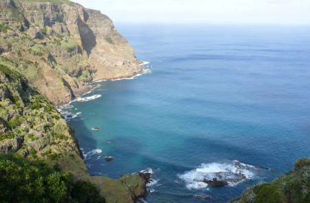
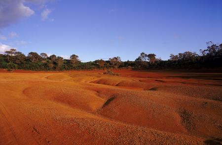
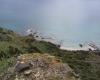
Continuing West, the trail follows a thick forest area that will lead you to another Geosite - Barreiro da Faneca, place of the last eruptive phase of the island where the red clay is abundant. At this stage of the trail, along the dry land, there are several detours accessing viewpoints over the North Coast, especially the viewpoint of Ponta do Pinheiro and of Baía da Cré.
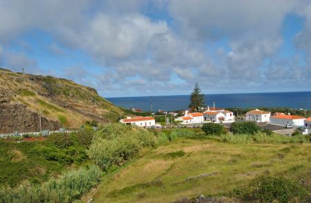
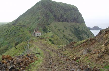
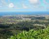
Arriving to the end of this dry land, the trail takes you up Monte Gordo, place with a whale tower. From here, go to Ponta dos Frades, continuing alongside Ribeira dos Lemos towards Anjos, where the history of the settlement of Santa Maria is highlighted by the presence of a small chapel, probably the first Christian temple of the Azores, and the statue of the seaman Cristovão Colombo, at the center of the village. From here it is possible to do the GRA 01 SMA - Grande Rota de Santa Maria, towards Vila do Porto.
Outline
Trail Information


