Fajã da Caldeira do Santo Cristo

Santa Maria

Areia Branca

Trail Information
Category - Linear
Difficulty - Medium
Extension - 11.5 km
Time average - 4h30
Trail Info

This linear route connects Praia Formosa (South coast) to Baía of São Lourenço (Northeast coast), making the connection between the two white sand beaches (limestone sand), unique in the Region.

Along this trail, you will cross classified areas such as the protected area for management of species or habitats of Pico Alto and the protected landscape area of Baía of São Lourenço.

Great Route of Santa Maria

Trail Info

The Great Route of Santa Maria takes in the whole island and over 78 circular km of lanscapes incluing areas of great geomorphological interest. On the trail, you will see evidence of several types of erosion and sea water levels changing, which conveys the island’s  particularities to places of incredible scenic beauty, as well as areas of educational and scientific interest. 

Discover beautiful fauna, and considering the location of the Azores in the Northeast Atlantic, several species of migrant birds which use the Azores as a resting place. 

Santa Maria

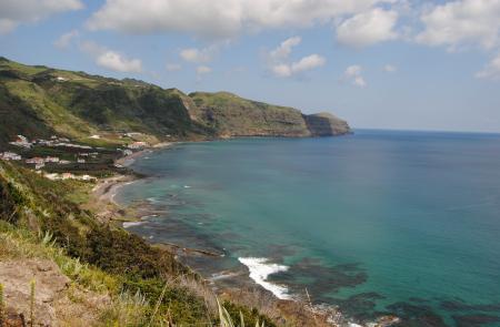
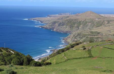
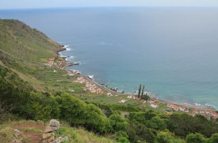
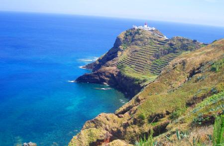
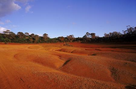
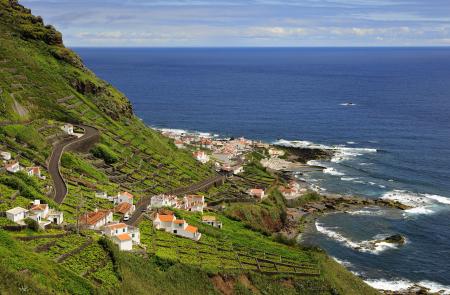
Location and Climate

As part of the Oriental group, Santa Maria is located 55 miles south east of San Miguel, and thereby the most meridional island of the archipelago.

With a total surface of about 97 km2, it is 18 km long and 10 km wide at its most.

Position: 28º08' W and 37º43' N.

It has a mild climate with average temperatures of 12º C (54º F) during the winter and 25º C (77º F) during the summer.

English

Costa Sul

Trail Information
Category - Linear
Difficulty - Medium
Extension - 8 km
Time average - 3h00
Trail Info

Este percurso liga Vila do Porto à Praia Formosa, vila de Almagreira, onde se realiza o festival de música mais antigo do país, a Maré de Agosto.

Santo Espírito - Maia

Trail Information
Category - Linear
Difficulty - Easy
Extension - 4.1 km
Time average - 2h00
Trail Info

Este pequeno percurso liga a vila de Santo Espírito ao lugar da Maia, zona sudeste da ilha. Inicie o percurso junto à Igreja de Santo Espírito, passando pelo Museu Etnográfico de Santa Maria, seguindo em direcção a Nascente, em direcção ao mar. Siga as marcas ao longo da estrada até chegar a um antigo moinho de vento. A partir daqui, a estrada de terra serpenteia por um bosque de Queijo Australiano ( Pittosporum undulatum ), passando por uma antiga fonte e depois por pastagens.

Entre a Serra e o Mar

Trail Information
Category - Circular
Difficulty - Medium
Extension - 9.8 km
Time average - 2h30
Trail Info

This circular route begins near the church of Santa Bárbara parish, northeast part of the island. 

Go west, along the road that fives place to an alley accessing pastures.  Go up until the place of Covão da Mula from where you can see the center of Santa Bárbara and also the place where the population used to extract clay for domestic use.

Pico Alto

Trail Information
Category - Circular
Difficulty - Medium
Extension - 6.2 km
Time average - 2h
Trail Info

This small circular route covers a forest area inserted in a protected area, passing through several natural viewpoints from where it’s possible to see different landscapes of the island.

Start the trail in the Pico Alto car park and climb a stairway near a military building to reach the highest point of the island, which boasts views over Santa Maria.

Costa Norte

Trail Information
Category - Linear
Difficulty - Medium
Extension - 8.4 km
Time average - 4h00
Trail Info

This small linear route connects the village of Bananeiras to Anjos, in a small walk along the North Coast of the island.

Leave Bananeiras towards Baía do Raposo. This trail, often used by people that go fishing to the bay, classified as Geosite, allows you to visit two watermills, the stream that feeds them and a mill belonging to the local vineyards, presently in ruins.

Santa Maria

NATURE

The Yellow Island

Since it is located further to south and to east, the island of Santa Maria has a warmer, drier climate with lower levels of rain, which contributes to the higher dryness of the land and vegetation, which is yellowish.  Santa Maria is also known as the Island of the Sun.

GEOGRAPHY

With 16.6 km of length, 9.1 km at its maximum width and a total area of 97 km2, the island of Santa Maria has 5,552 inhabitants (2011 data). Together with the island of São Miguel, it forms the Eastern Group of the Azores Archipelago, with the two islands distancing 81 km from each other. Pico Alto, the island’s highest point, reaches an altitude of 587 m and is located at 36º58’59’’ latitude north and 25º05’26’’ longitude west.

Subscribe to RSS - Santa Maria